Sand Ripple Imaging Sonar
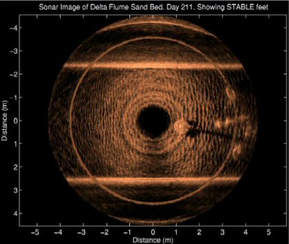
The image above was measured using the Sand Ripple Imaging Sonar and shows small sand ripples as well as the feet of the STABLE II instrument tripod. Dark areas of the image represent low signal levels, or shadows, whereas bright areas represent strong signals, or targets. The sides of the flume define the upper and lower boundaries of the image. The central hole results from the height of the sonar above the seabed and the vertical beam pattern of the sonar transducer. The Sand Ripple Imaging Sonar is mounted vertically on a pole suspended from above the flume which causes a shadow in the six o'clock position.
The Sand Ripple Imaging Sonar has a narrow horizontal beam pattern and a wide vertical beam pattern. The transducer is rotated in the horizontal plane and data gathered for every 0.9 of the revolution.
The sonar operates as a slave to a host computer which controls the sonar via an RS232 serial data link. The acoustic receive signal is amplified and sent to the host computer as an analogue signal allowing free control over the digitisation of the data at the surface.

|
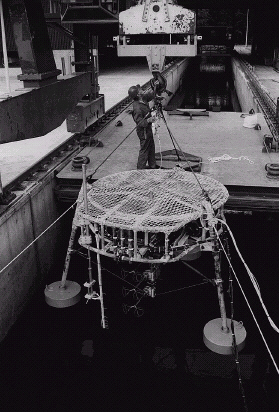
The STABLE II platform being lowered into the flume to act as a target for the Sand Ripple Imaging Sonar
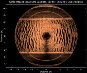
The platform has now been removed from the flume and the ripple period enlarged. The imprints of the platform feet are clearly visible.

|